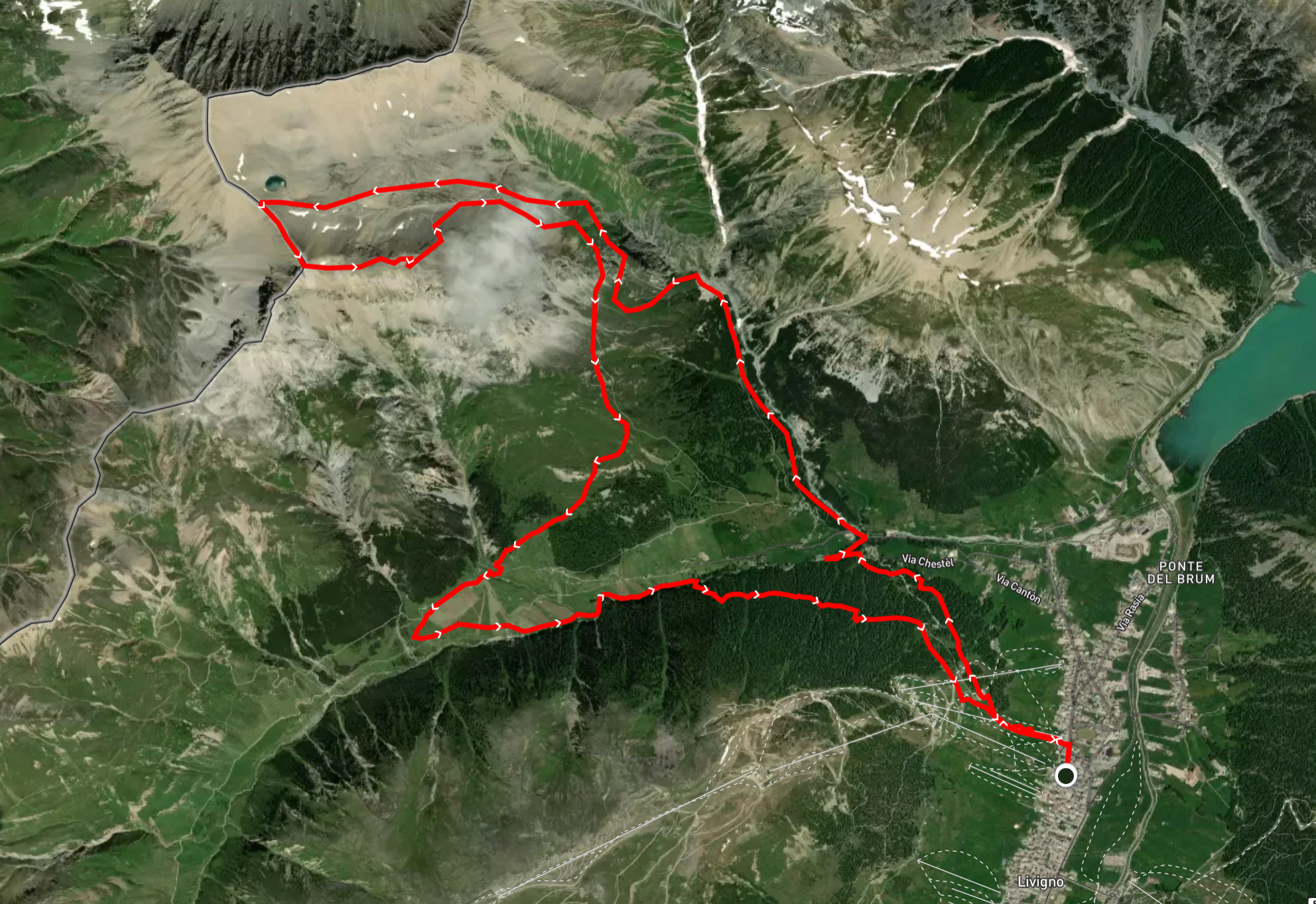
REFRESHMENTS:
“BROOKS – LIVIGNO SKY TRAIL” (17 km): there are 2 refreshment points along the route + 1 final refreshment point:
- Piz Casana (Piz Chaschauna) – km 7.1;
- Val Federia (Tee dopo Rin Toscie) – km 12;
- Livigno FINISH LINE – km 16.8.
MANDATORY EQUIPMENT:
After the inspection done by the Course Director on the two race tracks, and considering the weather forecast, here you can find the list of MANDATORY EQUIPMENT that will be the same for both races (Skymarathon and Sky Trail):
– K-way (minimum 10 Schmerber) or jacket with hood;
– Mobile phone (switched on);
– Flask or cup with water reserve;
– Buff headwear or hat;
– Gloves;
– Rescue blanket.![]() The compulsory material will can be checked before, during and at the end of the event. If a runner will be found without compulsory material will be disqualified. In case of bad weather the organization will communicate the updated compulsory material during the race briefing of Friday.
The compulsory material will can be checked before, during and at the end of the event. If a runner will be found without compulsory material will be disqualified. In case of bad weather the organization will communicate the updated compulsory material during the race briefing of Friday.